View This Article in BOSS Magazine
A behind-the-scenes look at how GIS data touches critical infrastructure, from Esri, the world’s pre-eminent GIS technology developer

As Hurricane Debby was churning towards Florida and the southeastern U.S. in early August, we had the opportunity to speak with Matt Piper, Global Industry Solutions Director, Infrastructure for Esri, the global leader in geographic information systems (GIS) software, location intelligence, and mapping. Their pioneering geographic approach leverages enterprise-grade GIS technology to address global challenges, driven by their mission to use science and technology to create a sustainable world.

Matt Piper
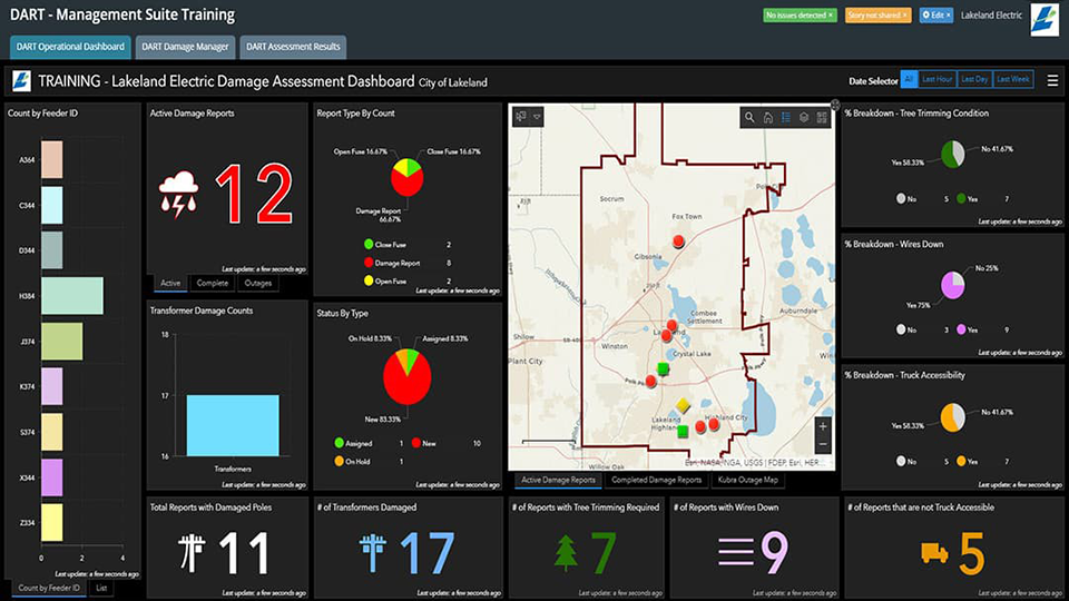
Esri technology returns holistic insights into the innumerable issues impacting our planet. The enormous amount of location data they track includes significant weather events – in this case, the current Cat. 1 hurricane – and clarifies the impact it will have on critical infrastructure, whether it's on the electricity network, water network, telecommunications, or other essential infrastructure services. As a storm moves on, the GIS is essential for the planning, responding, and recovery. Utilizing location intelligence, organizations can model for the anticipated winds, storm surge, and any flooding that may occur which enables a safer and faster response.
Piper leads the company’s infrastructure Industry Solutions division. “We help those organizations that are impacted to better understand what's happening now and also what's likely to happen in the future by unifying complex datasets through location,” he told us. “We have the foundational tools to model the network itself, visualize the terrain and the environment, and we can also bring in real time datasets like weather or road closures, and get as much information as possible to the right people when they need it. Esri coordinates with public and private entities to deliver information through maps and applications to bring location data into multiple business decisions and workflows for improved decision-making.
Esri’s largest market sectors are federal government, State and Local Government and Utilities. Almost every organization in the United Stated uses Esri’s ArcGIS software in one way or another. But the applications of GIS technology is used across almost every industry, including, supply chain, logistics, education, natural resources emergency management, and health. At the dawn of the Covid crisis, a dashboard that tracked daily case and death counts from data provided by Johns Hopkins University was built. “That became probably the largest hit dashboard in the history of dashboards,” Piper said of the more than trillion hits it received. “GIS was the way the world understood what was happening on a global scale. That dashboard was built utilizing our technology.”
Investing in global change
GIS has been redefined to involve a plethora of different systems to generate the meaningful intelligence our fast-moving global societies require, from imagery management, business intelligence, field operations, Network management, environmental management, and of course emergency management. As Piper emphasized, “It's that ability to share and collaborate information across not just your organization, but externally with other stakeholders.”
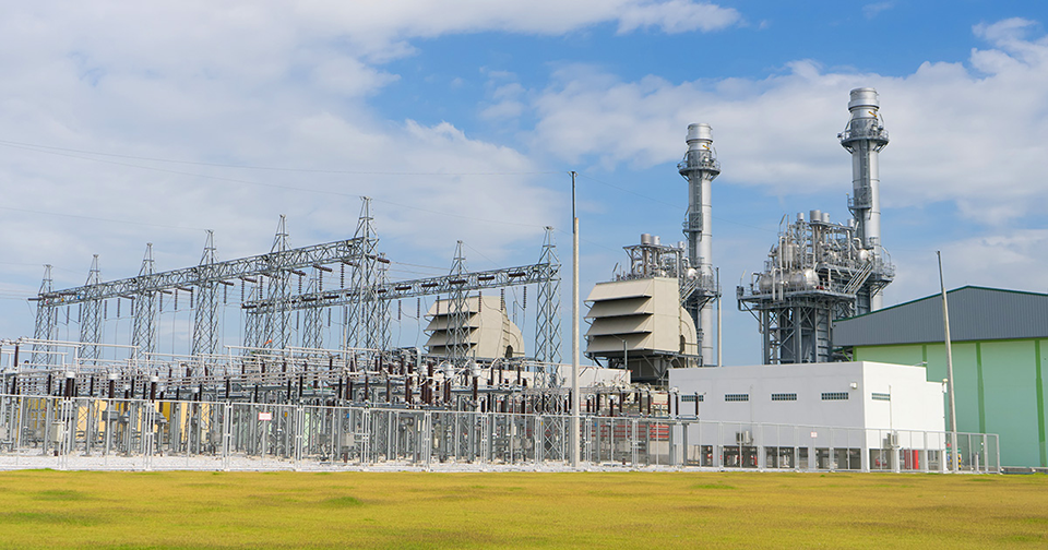
From an infrastructure perspective, power lines, water or gas networks were traditionally expressed in points, lines, and polygons on a map managed by the GIS team and shared for data capture or field editing. “This is no longer the case,” Piper stressed. “Yes, GIS impacts the way that you visualize your network, but a modern Enterprise GIS has redefined how you manage it and how it works with your other enterprise systems.”
For example, the latest data model from Esri can manage the electric network from generation through transmission, distribution, and then beyond the meter. It is a complete network information model that understands how the grid is designed to operate including the impacts of distributed energy resources like rooftop solar panels, or electric vehicles. “We understand the entire data model, and it's also how it's connected. Our technology understands the topology and its connectivity, it really is an intelligent topology that allows us to understand and model how the network is designed to operate but also allows you to adapt, innovate and meet changing business needs or regulatory changes.”
ArcGIS for utilities is not just a simple visualization technology. It's an engineering tool purposely built to manage a modern network. The impact of distributed energy resources, electric vehicles, battery storage, and data centers on the grid are changing the landscape of critical infrastructure management, and GIS incorporates data from multiple other systems. This is transformational shift for utilities on how they model a modern network and may require organizations to explore and improve their data quality, accuracy, and completeness. Esri has numerous training packages available to help customers with their implementations, but also have many System Integrator partners like RAMTeCH who have undergone extensive training and developed tools to help customers analyze their data and prepare for migrations to this modern network Information model.
“GIS is unlocking value across your entire organization automating workflows and processes beyond just managing your network information. A focus area has been how GIS can better utilize the capture and management of imagery data. GIS is a comprehensive imagery management system, from flight planning, putting drones into the air, to capturing the imagery, LIDAR and point clouds, processing it and then visualizing this imagery it in beautiful 3D scenes. It is amazing how far technology has come to manage the big data sets associated with imagery, and how now we can bring all that imagery back and manage it throughout the entire life cycle,” he explained.
Esri technology also integrates process automation and AI machine learning to then automate what the imagery captured can then be used for. By running there AI pre-trained learning models the imagery can be used for change detection, object detection, and feature extraction, turning all this imagery into a critical piece of enterprise information that can be shared and used across many departments.
A strength of Esri is it doesn’t just end with the core capabilities of ArcGIS, they have many great partners working in this innovative space, like buzz solutions, who have built AI powered work flows on top of our technology to optimize visual inspections and maximize customer savings.
Esri is also working with organizations to build out new solutions to accommodate the demands of a modern grid. “The U.S. grid is a massive complex system, but it is aging, requires significant augmentation, but it also requires a lot of new construction to meet the rising demands of load increases as everything is being electrified, and new significant loads like those from data centers are being added at record rates,” he said. “We are facing challenges we have not seen before; we need to build out new infrastructure at scale, but we also need to make sure that is done in an equitable way. This is where GIS helps, it provides site suitability analysis, manages the project delivery, and ensures that your capital programs are delivered across regions in an equitable way by utilizing data sets from census data, Justice40, and underserved communities.”
Location technology allows the integration of datasets from multiple different sources. “It becomes this ultimate integrator of information, and by layering these datasets on top of each other, you can see insights in ways that you couldn't before,” he said of the millions of datasets Esri provides.
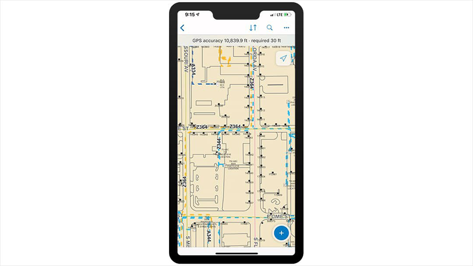
Can external authoritative datasets be trusted? “They might just be live weather feeds or traffic, but you bring them in, overlay them through GIS to provide additional context, and then you can share that with the rest of the organization or to external parties. It becomes a hub for sharing and collaboration in ways we've never been able to do before.”
The multibillion-dollar innovator feeds a third of their revenue back into R&D, creating geographic solutions to the challenges of change. “We're continuously releasing multiple releases per year of our technology stack, and we have hundreds of different products across our industries, but we’re always looking ahead to make sure that we are building the technology to help solve future problems as well,” Piper said. An example of the work being completed to assist utilities solve for the future grid is evident with the recent partnership with Siemens to bring grid planning and operations of the distribution grid to a new level.
The trajectory of social, government, and industry challenges won’t just be tracked by Esri technology. The success of GIS at a global scale is also credited to the extensive capabilities of Esri Partners. Esri has thousands of global partners of all sizes and disciplines, aligned and invested sharing Esri’s vision to create the technology for a better, resilient, and sustainable world.
Esri is the global market leader in geographic information system (GIS) software, location intelligence, and mapping. Since 1969, we have supported customers with geographic science and geospatial analytics, what we call The Science of Where. We take a geographic approach to problem-solving, brought to life by modern GIS technology.
Corporate Office
380 New York Street
Redlands, CA 92373
Phone Number: 909.793.2853
Homepage Link: https://www.esri.com/
Facebook: https://www.facebook.com/esrigis
Twitter: https://x.com/Esri
LinkedIn: https://www.linkedin.com/company/esri/
YouTube: https://www.youtube.com/user/esritv
Instagram: https://www.instagram.com/esrigram/

